Monday, May 26, 2014

5/25/2014 Supercell west of Hobbs, NM

Thunderstorm lab day two of our CoD trip was a bust...er...just kidding!

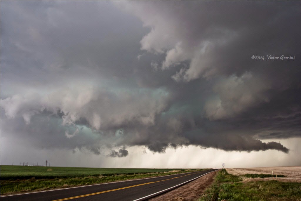
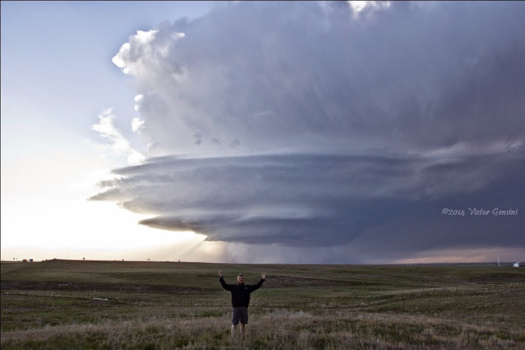
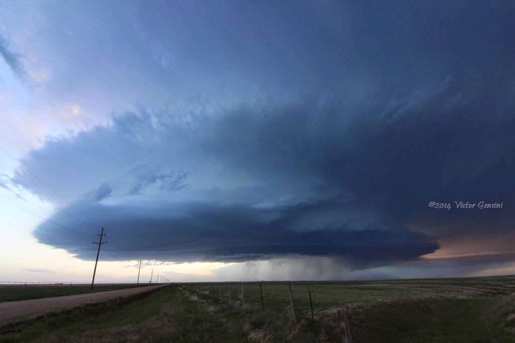
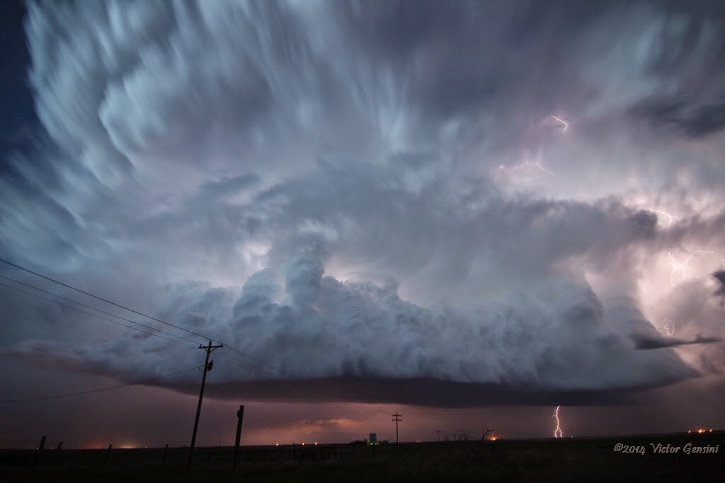
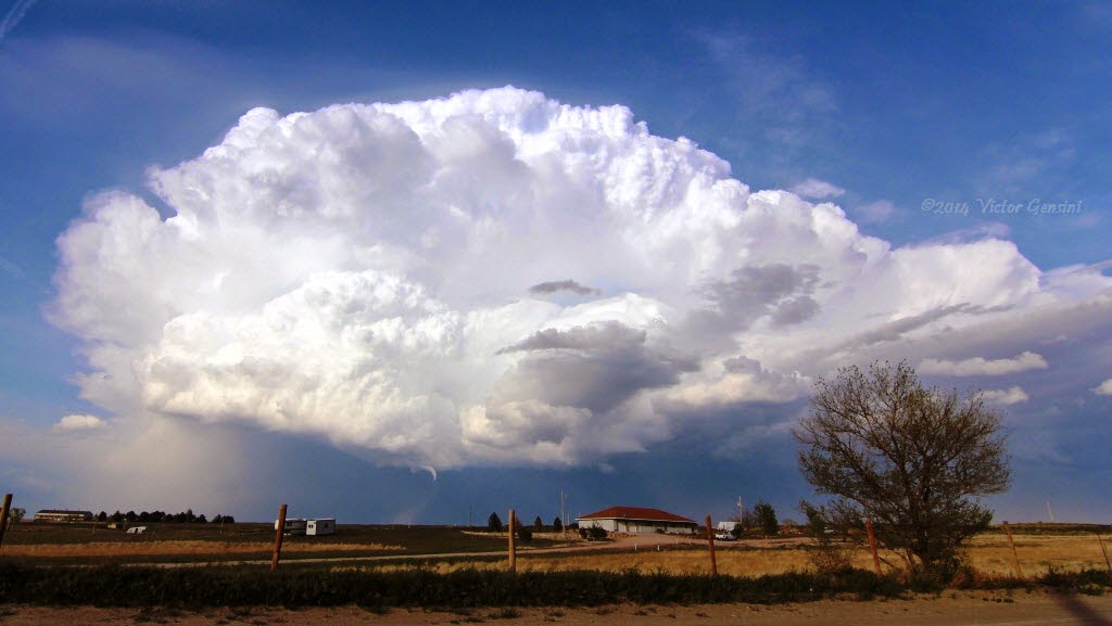
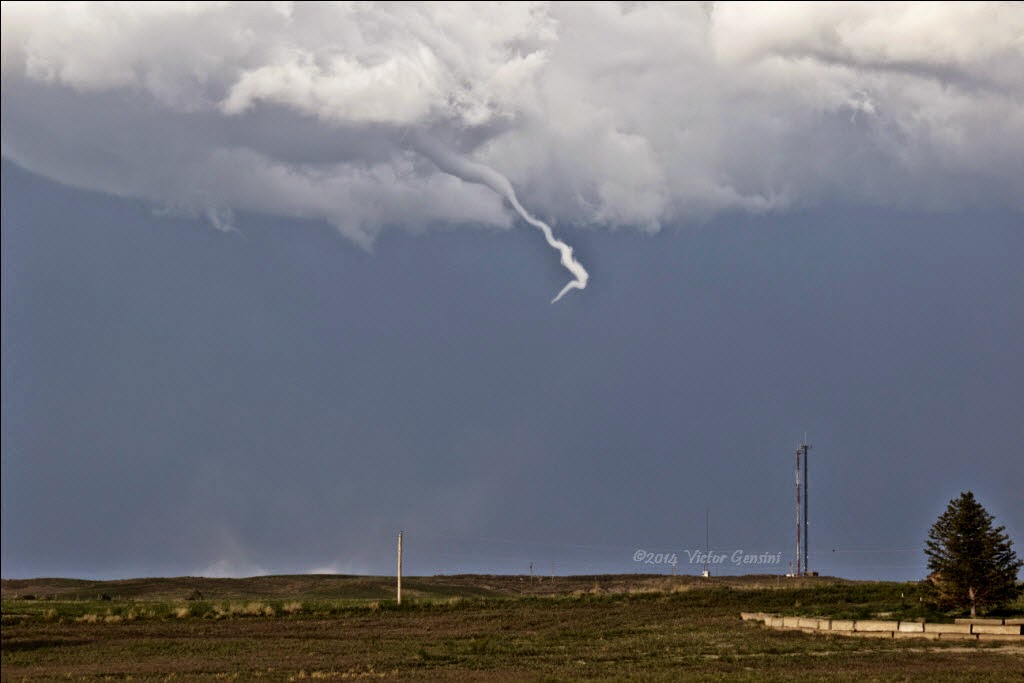
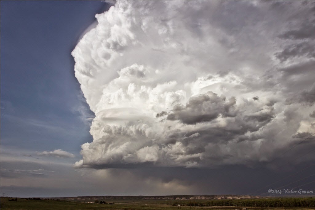
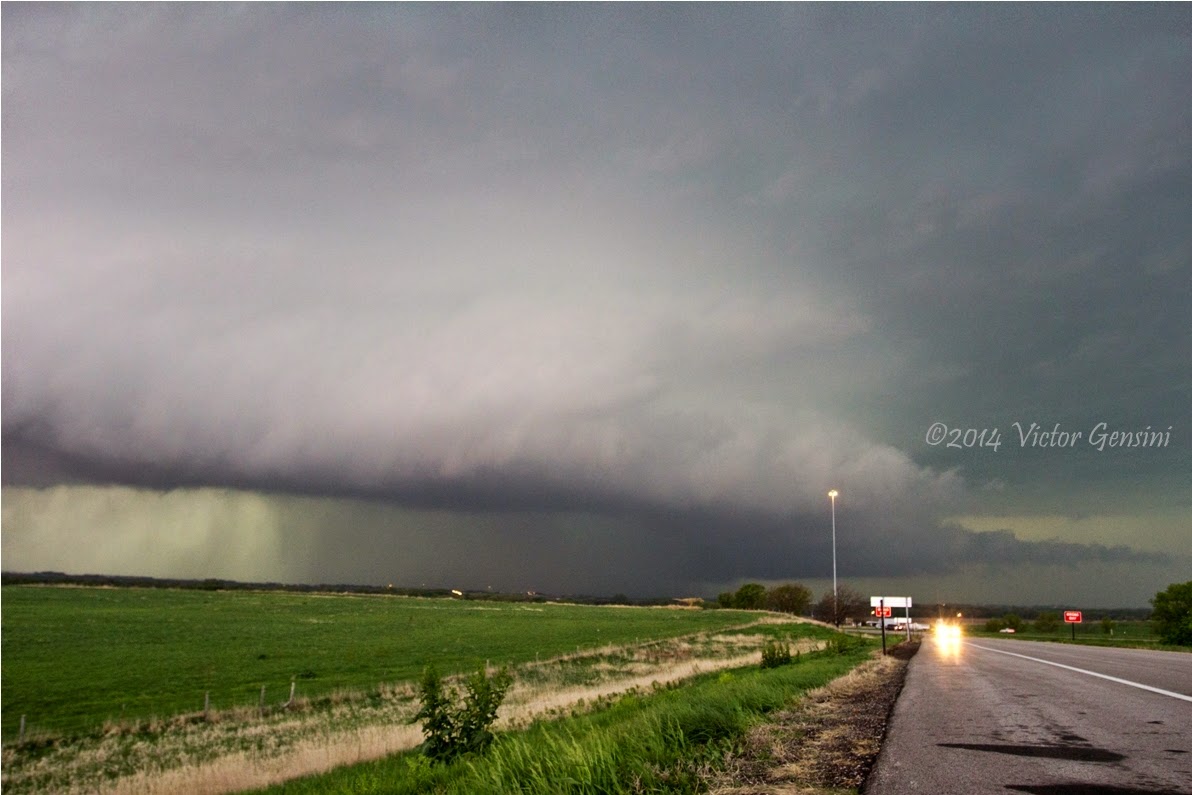
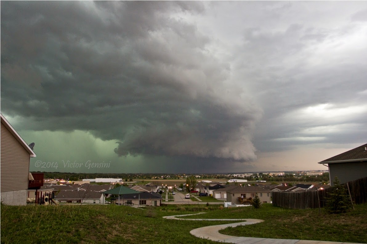
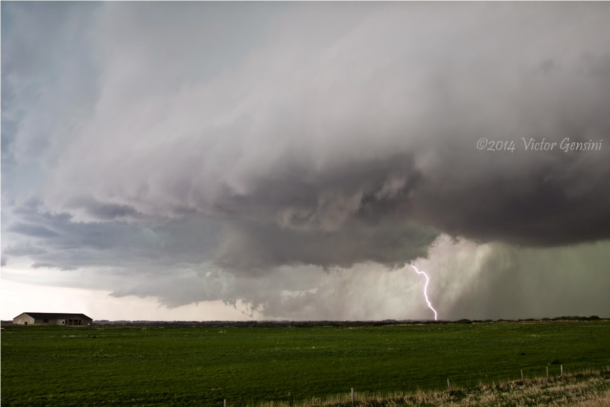
Our initial target was near Fort Stockton, TX.  As we drifted to this area, a late morning severe storm became interesting west of Sanderson.  Of course, by the time we got there, the storm fizzled out and we were left scratching our heads.  The only other play that we felt had potential to materialize was southeast New Mexico.  On we went! We got to Hobbs, NM, and stopped to check out our surroundings.  We played some softball in the park on the north side to kill some time (ask the trip participants about the score of that game some time). As the storm immediately to our southwest began to fizzle, we called it quits and went to check into the hotel. As *soon* as I came out from hotel check-in to pass out room keys, it was clear that a rapidly developing storm to our west was worth going to take a look at.  This storm matured into a majestic high plains supercell, with everything a structure freak could ask for.  We stuck with this storm back to Hobbs where we choked down Applebees (the worst food and service ever) and overnighted at the Fairfield Inn.

I have a lot more time lapse from this storm via my GoPro (thanks Pops!) but I will wait to process it until we return home. You definitely want to see the shorter time lapse version below. 


Sunday, May 25, 2014

5/24/2014 Evening convection northwest of Pecos, TX

Saturday was my first chasing leading College of DuPage Trip 3. We awoke in SPS to a southward surging outflow boundary that ended up ruining our southern target option.  We changed course and set our sight on Pecos, TX to wait for initiation near the Guadalupe Mountains.  Convective initiation was quite delayed, but we were still able to catch a storm northwest of Pecos, TX, about 20 miles from the New Mexico border (I think we watched the storm below for about two hours near the intersection of TX Highway 652 and Pipeline Road).  We watched the storm light up the night sky under a glorious display of stars and planets, all while listening to select tracks from Pink Floyd's "Dark Side of the Moon" album.  It was quite an experience for the trip participants and I was excited that they were having a great time. Today (5/25) looks like more of the same for our region.


Saturday, May 24, 2014

5/21/2014 Supercell east of Denver, CO

The last promising day for Pops and I was in Colorado with strong southeasterly winds aiding a post-frontal upslope initiation scheme.  The Denver Convergence Zone never really got cranking given the southeast trajectories, but a storm was able to fire southwest of Denver and moved over the airport with significant hail present (causing some damage to Frontier aircrafts I believe). As the storm pushed east into manageable chasing territory, we navigated northeast of the hook echo in what was becoming a large HP supercell. We caught a glimpse of the reported rapid rotation and funnel clouds, but the storm was not able to constrict the low-level circulation into a sustained tornado.  You will see from the timelapse just how close this was to being a large, wedge shaped tornado.  I think if the surface temperatures were slightly higher, we would have been dealing with a significant event (I was chilly most of the day with a small jacket on!).  We released from tornado chase mode as the circulation became rain-wrapped and positioned far east to enjoy the structure that only lasted for an hour or so, but created some nice photo ops and put a cherry on top to a very successful few days in the High Plains.

PS, Pops is becoming really good at storm feature identification!

Watching planes fly overhead east of the Denver International Airport

About as close to producing a large tornado as you can get...
Timelapse (click to play)

Wednesday, May 21, 2014

5/20/2014 High Plains Hat Trick

Tuesday completed a 'hat trick' of days with severe thunderstorms.  Yet again, a modest upslope regime contributed to beautiful convection across southeast WY and western NE.  We latched onto the convection southwest of Chugwater and documented it all the way to Scottsbluff, NE. Another timelapse can be found at the very end.


Tuesday, May 20, 2014

5/19/2014 Sydney, NE to Julesburg, CO Supercell

Monday exhibited another modest moisture upslope regime across the NE panhandle and western WY.  Trajectories turned easterly a little late, but organized convection was able to form near Kimbal, NE and slowly drifted toward Julesburg, CO toward sunset.

It was an interesting storm from a forecasting perspective.  SPC dropped the slight risk during the 1630 UTC update, only to solidly verify the initial morning outlook from Greg Carbin et al. Kudos, Greg et al.!

This (the most southern of) storm provided magnificent photo ops and great scenery as the day drew to a close.  I will take days like these over Oklahoma high-risk tornado setups 99 out of 100 times.  Pops and I also had a chance to resurrect the popular 2013 supercell photo from Nebraska. Overnighting in Julesburg, CO and looking forward to the next couple days.


Monday, May 19, 2014

5/18/2014 James, NE LP Supercell

Sunday featured meager moisture across the high plains in a modest upslope regime.  We awoke in Rapid City, SD and trekked through the Black Hills National Forest before setting our sights on Lusk, WY as an initial target.  The ferry to Lusk was scenic and provided relaxing landscapes before hanging out most of the afternoon in a Family Dollar parking lot.

We were eyeing a developing storm to our southeast near Torrington, WY, and went after it (with some admitted hesitation).  Visually the storm looked great, but the RADAR signature said otherwise, especially after initial development.  Anyway, we stuck with this storm as it morphed into a beautiful high plains LP supercell.  It produced a brief tornado near James, NE (just northeast of Scottsbluff), but mainly just provided an amazing view for the afternoon / evening.

Be sure to watch the timelapse at the end!

Overnighted in Alliance, NE.


Various pictures of the brief funnel / tornado


Tuesday, May 13, 2014

5/11/2014 Southeast Nebraska HP Supercell

Skip Talbot, Jennifer Brindley Ubl, and I ventured out to the plains early Sunday morning to setup for an enhanced risk of tornadic supercells along an east to west oriented warm front in southeast Nebraska.  A moderate risk was already in place due to the outstanding forecast hodographs.

Setup perspective via visible satellite and mesoanalysis 
One potential pitfall of this setup was the lack of steep low-level lapse rates, as exhibited by the morning RAOBS.  Nevertheless, we latched on to a rapidly developing supercell north of Hebron as it quickly produced a large (but brief!) multi-vortex tornado.  We could only see the tornado because of our position in the notch.  Despite the difficult storm motion and HP nature of the storm, I never felt at risk of being overtaken because of our very cautious nature.  We quickly got in and out of that area only stopping for a few moments to peek into the bear's cage.  It was a tough chase, indeed, with poor visibility, crappy road conditions, and less-than-ideal cell data service.

The storm was north of the warm front for most of its lifecycle, constantly breathing on air that was chilled from the morning convective outflow.  It did make several attempts to surge toward the boundary, but could never quite latch on and make a right turn.  I have a feeling we would have had a violent, long-track tornado on our hands if that storm could have made a good connection to the WF.

Brief cone tornado (right center) and what appears to be a large wedge tornado (left center)
Skip and I discussing storm structure
Initial large multi-vortex circulation with brief tornadoes
Check out more pictures over on Jen's BLOG.

Good to be back in chase mode.

Large rain-wrapped circulation along I-80 just southwest of Lincoln, NE
What was left of the circulation as it passed over Lincoln

Time lapse of the day