Time lapse of about half of today's driving commute. I wish it went by that fast!
Thursday, June 25, 2009
Tuesday, June 23, 2009
Chicago Hustle & Bustle
Monday, June 22, 2009
6/22/09 Highway 20 Tornadoes
Sunday featured an interesting set-up for tornadic supercells in central IA along a northward advancing warm front. After a late start, Hampton IA was our initial target. After hopping on HWY 20 west of Waterloo, IA we busted west to catch up with some cells forming near Fort Dodge, IA. As we pulled up to these cells, a nice wall cloud formed and after some organization, produced a tornadic circulation east of Owasa. After heading east to watch another circulation forming near Dike, IA, we kept heading east to stay ahead of the slowly moving storms. We were able to see the tornado with debris cloud that hit structures in Dike, but the pictures turned out to be non-existent as the contrast was terrible. Oh well. We chased visual the entire day with help from Gilbert Sebenste and Alan Black giving us radar updates over the phone, as I didn't have the power cord for my laptop...Argh! (Thanks to them...) Gilbert navigated us south after the Dike, IA storm south to another tornadic supercell heading for Iowa City. After busting through precip, we were once again treated with nice juicy inflow, and as the long exposure shows, a HP supercell. Not bad for a Sunday chase!
I will update with a time lapse from todays activities when I have time.
6/19/09 DeKalb Sunset
Monday, June 8, 2009
6/7/2009 What the Hail?
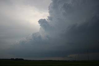
On Sunday, NIU alum Dustin Oltman and I ventured out to the Middle Mississippi Valley to try to catch some tornadic supercells since this year has been such a bust for me. I was happy to get out and try my luck in a place that I have never chased (nor do I want to again...). Despite crappy terrain/roads, we were able to cross the Mississippi River into NE Kansas and catch up with a beautiful slow moving LP supercell in Jackson county Kansas. This cell had some awesome structure and a very intense updraft! After watching this cell develop an inflow band and attendant wall cloud, it started to weaken and we decided to catch up with a supercell that looked awesome visually just to our south (we chased most of the day without internet, Argh!). This storm had some of the largest hail I have ever seen (up to baseball size on the ground after at least 15 minuets of melting). This storm also went on to produce grapefruit size hail in the town of Guthrie, Missouri. About the best day you can have without getting a tornado!

Intense updraft of an LP cell (looking west) in Pawnee county NE
Subscribe to:
Posts (Atom)


